MANLY WARRINGAH DISTRICT
| The
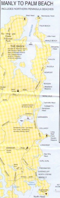
Manly Warringah District is in the Northern Suburbs of
Sydney, New South Wales, Australia. It extends from the
North Head of Sydney Harbour to the Barrenjoey Headland
at the Southern entrance to Broken Bay. It now includes
the three local government municipalities of Manly,
Warringah and Pittwater. It is often referred to as the
"Northern Beaches", simply "the
Peninsular" or as "God's own country". The birth of Australia is celebrated on 26 January, the anniversary of the establishment of the Colony of New South Wales by Captain Arthur Phillip at Sydney Cove in 1788. However "Manly" was named prior to this date. Phillip had wisely rejected Botany Bay in what is now the South Sydney, St George and Cronulla districts and looked further north for a suitable location for settlement. Phillip thereby discovered Port Jackson (Sydney Harbour), the magnificent harbour that Captain Cook had sailed past in 1770.
|
 |
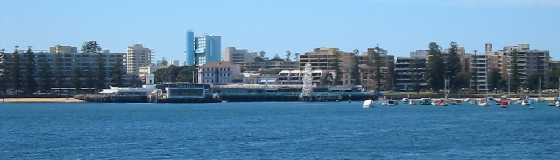
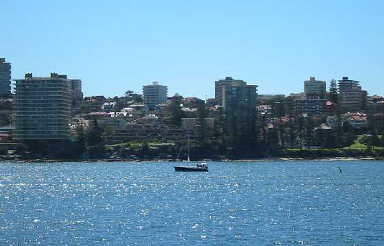
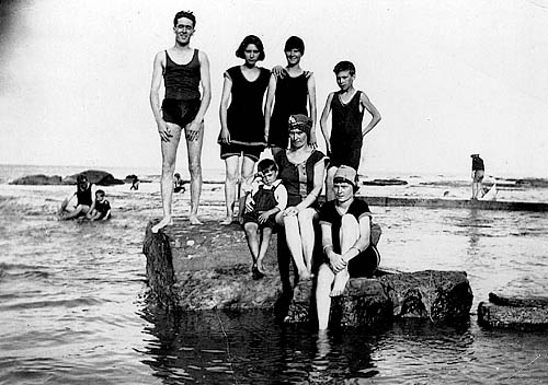
It wasn't until 1846 that development of Manly really started and Manly did not become a municipality until the 1870s. But, nowhere in the world is quite like Manly, "seven miles from Sydney, a thousand miles from care". On its own small peninsula, it's bounded by Sydney Harbour, the Sydney Harbour National Park and the ocean. One of the first seaside resorts to allow daylight swimming and surfing back in 1903, Manly offers the unique combination of wide ocean beaches on one side and serene sandy harbour coves and inlets on the other. The area is 16.26km² and has a boundary 39.4km, of which 29.9km is a water margin. [www.manly.nsw.gov.au/]
The Warringah region is immediately north of Manly. It is an aboriginal word that has many interpretations including "sign of rain", "across the waves" and "sea". [www.warringah.nsw.gov.au/] I like to think of it as meaning "by the sea" which when combined with Manly means "men of manly bearing beside the sea", an apt description of the Manly Warringah Rugby League Team.
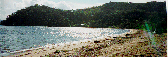
Exploration into Warringah began within the first weeks of settlement at Sydney Cove in 1788. Governor Phillip made a number of journeys throughout the area, detailing the landscape, flora and fauna, as well as observing Aboriginal lifestyle and culture. Despite its relative proximity to Sydney, Warringah remained predominantly rural throughout the nineteenth century, with small communities in the valleys between the headlands. The peninsula’s isolation and difficult terrain were natural barriers to expansion. Before bridges were built, the road distance from Sydney to Manly via Mona Vale Road was seventy miles. When the Warringah Shire was proclaimed in 1906, it covered an area of 264 square kilometres and the population was approximately 2,800 occupying 700 dwellings. Today Warringah is a diverse community with a population of 131,000 people covering 152.55 square kilometres. [www.warringah.nsw.gov.au/] Pittwater Council was founded on May 1, 1992 by NSW Government proclamation following a long and energetic campaign for secession from Warringah Council by many Pittwater residents. Situated at the far end of Sydney's northern beaches, Pittwater is an area renowned for its natural beauty and quality of lifestyle. It contains long stretches of open beach, rugged headlands and sandstone sea cliffs, tranquil waterways, native bushland with pockets of rainforest, wetlands providing sanctuary to myriad bird species, and rock platforms bursting with marine life. [www.pittwaterlga.com.au/]
|